The Independent Campus Learning Program (MBKM) at Universitas Negeri Malang is implemented with learning activities inside and outside the university. The Chancellor of the State University of Malang through the Chancellor's Regulation of the State University of Malang Number 23 of 2021 concerning Guidelines for Implementing Teaching Assistance in Education Units, considers that to implement the implementation of the learning process outside higher education institutions, one way is with Teaching Assistance in Education Units. The Teaching Assistance Program in the Education Unit is a Form of Learning Activities (BKP) of MBKM to accommodate the fulfillment of students' learning rights as a learning process in fulfilling part of the period and study load in non-university institutions. Teaching assistance in educational units is a form of learning activities carried out by students collaboratively under the guidance of teachers and supervisors in formal education units. Teaching assistance activities in this education unit are carried out for 1 semester (equivalent to 20 credits) or approximately 6 months with an implementation time of 20 weeks. This activity aims to provide opportunities for students in the field of education to participate in teaching and deepen their knowledge by becoming teachers in educational units.
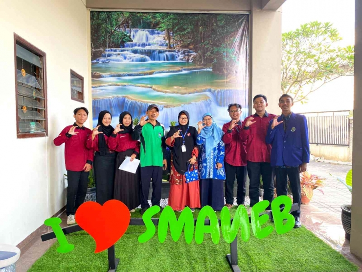
Learning activities in the form of Teaching Assistance are carried out by students in educational units such as elementary, middle, and high schools. Schools where teaching practices can be located in cities or in remote areas. One of the partner schools at Universitas Negeri Malang which was used as the place for Teaching Assistance was SMA Negeri 1 Bululawang. SMA Negeri 1 Bululawang as a partner school at Universitas Negeri Malang accepts Teaching Assistance (AM) students well. There were 6 students from the Geography Education study program, including (1) Khoirul Habibah, (2) Laksono Dwi Nugroho, (3) Muhammad Ibnu Fajar, (4) Muhammad Tegar Ramdhani, (5) Muhammad Wildan, and (6) Nanda Pratiwi. Each study program student group is accompanied by a Field Supervisor (DPL), namely Ms. Ferryati Masitoh, S.Si., M.Sc. as well as two Pamong teachers, namely Mrs. Dra. Chanifah, M.Pd. and Mr Dr. Supriono, M.Pd.
Teaching Assistant Student (AM), Geography Education State University of Malang (UM) successfully held a disaster emergency response simulation. Dozens of students looked cheerful and engrossed in learning to do a disaster management simulation. Apart from being important, apparently, it is also something new and fun for students. This activity was held with the existence of disaster mitigation-based geography learning activities from the geography education department of the Faculty of Social Sciences. This activity was themed "Disaster Response" which was held at SMAN 1 Bululawang. Disaster preparedness training is visualized through simulation activities or hands-on practice so that students understand what to do when a natural disaster occurs. As an effort to respond to disasters in the school environment, the disaster emergency response simulation activities carried out at SMAN 1 Bululawang involve various related parties, such as geography teachers and students of class XI Social Studies and Teaching Assistance (AM) students. The simulation participants numbered around 100 people.
Before this activity was carried out, the geography teachers from Teaching Assistance (AM) students gave explanations about the types of natural disasters. Then students are given material related to how disaster mitigation steps are taken to save themselves when a natural disaster occurs. These steps start before a natural disaster (pre-disaster), during a disaster, and after a disaster occurs. The activity was continued by the students by making a concept or design of a disaster mitigation simulation which would later be consulted with the geography teacher from the Teaching Assistance (AM) students. The simulation carried out is in the form of earthquake natural disaster mitigation. When a disaster occurs, an earthquake warning siren is signaled. In response to the warning, everyone involved in the earthquake disaster mitigation simulation activities immediately sought protection by going to a field or sheltering under something solid. Participants were appointed as the evacuation team to evacuate the injured victims.
During the simulation, the committee continues to monitor and evaluate the performance of all relevant participants. They check the speed of response, coordination between parties, the use of equipment needed during evacuation, and compliance with evacuation procedures. The results of this evaluation will later be used as a reference for repairing and improving the disaster response system at SMA Negeri 1 Bululawang. The committee team (AM Student) targets that in the future all students at SMA Negeri 1 Bululawang can participate in disaster emergency response simulation activities to increase awareness and preparedness of all parties in dealing with disaster emergency situations. Thus, this activity is also an effort to realize the condition of SMA Negeri 1 Bululawang which is ready to be safe through a disaster response simulation. "This disaster response simulation activity is urgently needed. This can be learned from an early age, one of which is through learning. Because earthquakes in Malang also often occur, this simulation is feasible and important to do. We will not know when a disaster will occur, a disaster can occur. happen at any time, so this activity is also useful for anticipating future disasters," said Nanda, Teaching Assistance Student (AM) of the Geography Education Study Program.
Laksono, Nanda's colleague added, "We also certainly know that Malang is flanked by several mountains, even these mountains are still active and still emit small eruptions. Just take the example of Mount Semeru, every morning I always see that the mountain emits ash and volcanic clouds with small amounts, and no vibrations are felt. But we will never know what activity is going on inside the mountain, it could be that even though the visible eruption is small, the activity that occurs inside is very dangerous and can cause very intense vibrations that led to an earthquake. That's why this simulation is important and urgent to be held." Prevention in disaster management is now something that needs to be done routinely and continuously with the aim of minimizing the impact of disasters both in terms of casualties and material.
